You have no items in your shopping cart.
Garmin / Tri tronics ![Garmin]() These collars are among the most rugged and reliable on the market from the top name in the business.
These collars are among the most rugged and reliable on the market from the top name in the business.
Garmin / Tri tronics

These collars are among the most rugged and reliable on the market from the top name in the business.
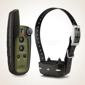
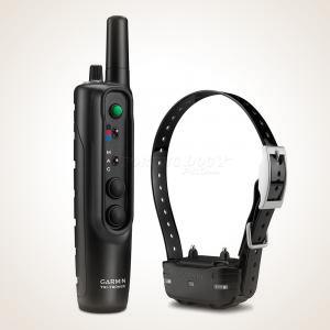
![Garmin Sport Pro E-collar System]() Garmin Sport PRO™ E-Collar$299.99
Garmin Sport PRO™ E-Collar$299.99![3/4 Mile]()
![Up to 3 Dogs]()
![Yes]()
![Garmin]()
![Stimulation Type]() Continuous, Momentary, Vibration, Tone
Continuous, Momentary, Vibration, ToneQuick-turn rheostat dial with 10 stimulation levels and positive clicks — full no-look, one-handed operation. Four dedicated buttons: continuous, momentary, vibration, tone. Auxiliary mode controls beacon lights and BarkLimiter remotely. 3/4-mile range, 3-dog capable, user-replaceable batteries, 60-hour life. Transmitter is IPX7 waterproof and floats...
![Garmin Pro 550 Plus]() Garmin Pro 550 Plus$749.98
Garmin Pro 550 Plus$749.98![2 Miles]()
![Up to 3 Dogs]()
![Yes]()
![Garmin]()
![Stimulation Type]() Continuous, Momentary, Vibration, Tone
Continuous, Momentary, Vibration, ToneThe Pro 550 Plus adds GPS tracking to Garmin's PRO series remote trainer. Pairs the PRO 550 Plus handheld with a TT25 tracking collar — train and track from the same device. 2-mile training range, 21 stimulation levels (Low/Med/High per dial position), up to 3 dogs, vibration, tone, BarkLimiter, LED beacon lights. TT25 provides GPS location with up to 9-mile tracking range on Garmin's network. IPX7 handheld (floats), 1 ATM collar...
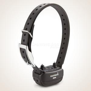
![Garmin Delta SE Training Collar System]() Garmin Delta SE Training Collar$249.99
Garmin Delta SE Training Collar$249.99![1/2 Mile]()
![Up to 2 Dogs]()
![Yes]()
![Garmin]()
![Stimulation Type]() Continuous, Momentary, Vibration, Tone
Continuous, Momentary, Vibration, ToneGarmin's simplest e-collar — three buttons, one tactile dial, no screen to navigate. 10 stimulation levels plus vibration. Half-mile range, 2-dog capable, IPX7 waterproof with a transmitter that floats. Charging clip keeps ports protected. 70-hour transmitter battery, 60-hour collar battery. For dogs 8 lbs and up...
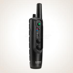
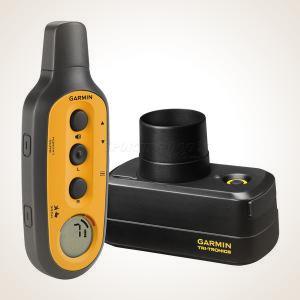
![Garmin Pro 70 System]() Garmin Pro 70 System$299.99
Garmin Pro 70 System$299.99![1 Mile]()
![Up to 6 Dogs]()
![Yes]()
![Garmin]()
![Stimulation Type]() Continuous, Momentary, Tone
Continuous, Momentary, ToneEntry point into Garmin's tube-style PRO series — same one-handed Tri-Tronics feel, scaled down. 1-mile range, 6 stimulation levels plus tone, up to 6 dogs via toggle switch, LED beacon lights on collar, built-in BarkLimiter with AutoRise. IPX7 transmitter (floats), 1 ATM collar, 60-hour battery. Compatible with PT 10 and PT 5/6 collars. The straightforward choice for trainers who want PRO-series reliability without the Pro 550's added features...
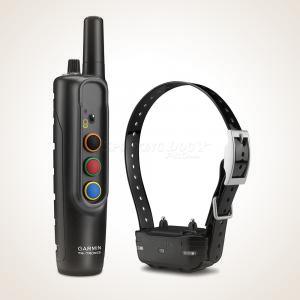
![Garmin Pro 550 System]() Garmin Pro 550 System$399.99
Garmin Pro 550 System$399.99![1 Mile]()
![Up to 3 Dogs]()
![Yes]()
![Garmin]()
![Stimulation Type]() Continuous, Momentary, Tone
Continuous, Momentary, ToneThe Pro 550 in its classic configuration — PRO series handheld with one PT 10 dog device, no GPS. 1-mile training range, 21 stimulation levels (Low/Med/High), up to 3 dogs, tone, BarkLimiter with AutoRise, LED beacon lights. Same tube-style Tri-Tronics interface with color-coded dog toggle. IPX7 transmitter, 1 ATM collar, 60-hour battery. Add GPS later by pairing with a TT25 collar (sold separately)...
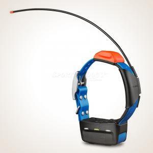
![Garmin Pro Trashbreaker System]() Garmin Pro Trashbreaker System$399.99
Garmin Pro Trashbreaker System$399.99![4 Miles]()
![Up to 9 Dogs]()
![Yes]()
![Garmin]()
![Stimulation Type]() Continuous, Momentary, Tone
Continuous, Momentary, ToneThe longest-range remote training collar on this page — 4-mile range, up to 9 dogs from a single tube-shaped transmitter. Familiar Tri-Tronics-style design with a top-mounted dial (6 continuous stimulation levels plus tone), color-coded buttons matched to collar colors, and a multi-dog toggle for fingertip switching. Remote-controlled LED beacon lights on the collar. Built-in BarkLimiter with AutoRise technology. IPX7 transmitter (floats), 1 ATM collar, 60-hour battery. Uses TB 10 dog devices — not compatible with any legacy Tri-Tronics collars...
![Garmin Bark Limiter Deluxe Collar (Rechargeable)]() Garmin Bark Limiter Deluxe (Rechargeable)$129.99
Garmin Bark Limiter Deluxe (Rechargeable)$129.99![Yes]()
![8 lbs. and up]()
![Garmin]()
Accelerometer detection reads throat vibration — not ambient sound. Autorise mode requires no setup: starts at level 1 and rises until barking stops, then self-resets. Built-in Bark Odometer counts corrections while you're away. 7 manual levels, vibration-only mode. Rechargeable battery lasts approximately 3 months. IPX7 waterproof. For dogs 8 lbs. and up...
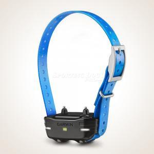
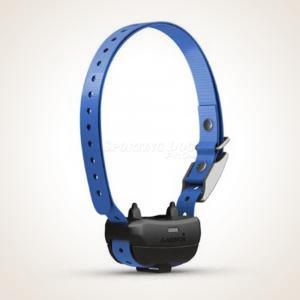
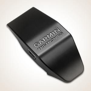
![Garmin PT10 Additional Collar - Blue]() Garmin PT10 Additional Collar$149.99
Garmin PT10 Additional Collar$149.99![Yes]()
![Garmin]()
Add-a-dog collar for the Garmin PRO 70, PRO 550, and Sport PRO systems. Features a 1-mile range, built-in BarkLimiter™, and remote-operated beacon lights. Available in blue or red strap...
![Garmin Delta SE Additional Collar]() Garmin Delta SE Additional Collar$99.99
Garmin Delta SE Additional Collar$99.99![Yes]()
![Garmin]()
Expand your Delta SE system to train a second dog, or replace a lost collar. Collar/receiver only — requires the Delta SE handheld (sold separately)...
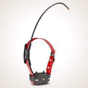
![Garmin TB 10 Dog Device]() Garmin TB-10 Dog Device for Trashbreaker$149.99
Garmin TB-10 Dog Device for Trashbreaker$149.99![4 Miles]()
![Up to 9 Dogs]()
![Yes]()
![Garmin]()
Add-a-dog collar for the Garmin PRO Trashbreaker system. Expands the system up to 9 dogs with a 4-mile range, built-in BarkLimiter™, and remote beacon lights...
![Garmin T5 GPS Dog Tracking Transmitter Collar]() Garmin T5X GPS Tracking Transmitter Collar$299.99
Garmin T5X GPS Tracking Transmitter Collar$299.99![Yes]()
![Garmin]()
GPS-only tracking collar for Garmin Alpha and Astro systems. Up to 9-mile range, 80-hour battery, and remote-activated LED beacon lights. Track only — no e-collar training capability...
![Garmin TT 25 Dog Collar]() Garmin TT25 Dog Tracking & Training Collar$349.99
Garmin TT25 Dog Tracking & Training Collar$349.99![Up to 9 Miles]()
![Yes]()
![Garmin]()
![Stimulation Type]() Continuous, Momentary, Vibration, Tone
Continuous, Momentary, Vibration, ToneAdditional TT 25 track-and-train collar for Garmin Alpha systems. GPS + e-collar in one slim collar, up to 9-mile range, 18 training levels, up to 136-hour battery with extended pack, and Wi-Fi auto-updates. Compatible with Alpha 10, 100, 200, 200i, 300, 300i, PRO 550 Plus, and Astro 430...
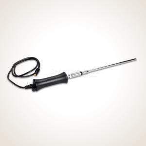
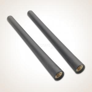
![Garmin Astro Long Range Antenna]() Garmin Astro Long Range Antenna$69.95
Garmin Astro Long Range Antenna$69.95![Garmin]()
Extend your tracking range on Alpha and Astro handhelds with a telescoping portable antenna. Collapses to 10.5” for pocket carry; extends to 42” when you need the extra reach. Compatible with Alpha 10, 100, 200, 200i, 300, 300i, Astro 320, 430, and more...
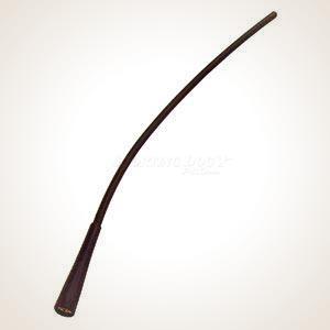
![Garmin Astro Extended Range Flex Antenna]() Garmin Astro Extended Range Flex Antenna$28.99
Garmin Astro Extended Range Flex Antenna$28.99![Garmin]()
Flexible 13” extended-range replacement antenna for Garmin Astro 220 and Astro 320 handhelds. Increases tracking range over the stock rubber antenna...
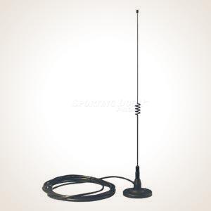
![Garmin Magnetic Mount Antenna for Astro and Alpha]() Garmin Magnetic Mount Antenna for Astro and Alpha$39.00
Garmin Magnetic Mount Antenna for Astro and Alpha$39.00![Garmin]()
Magnetic vehicle-mount antenna for Garmin Alpha and Astro handhelds. Mounts to your vehicle roof or hood; 11.5 ft. cable keeps the handheld inside the cab while you drive. Compatible with Alpha 10 through 300i and Astro 220 through 430...
![Garmin VHF Antenna (2-pack)]() Garmin VHF Antenna (2-pack)$19.99
Garmin VHF Antenna (2-pack)$19.99![Garmin]()
Replacement 5” standard VHF antenna for the Garmin Astro 430 handheld. Sold as a 2-pack. ..
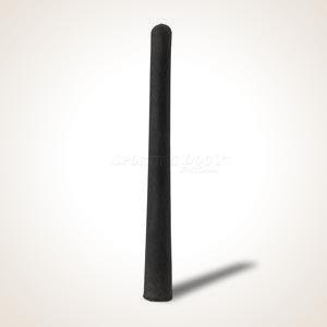
![Garmin Standard VHF Antenna]() Garmin Standard VHF Antenna$12.99
Garmin Standard VHF Antenna$12.99![Yes]()
![Garmin]()
Short Description: Replacement VHF handheld antennas for Garmin Astro 220, Astro 320, Alpha 100, and PRO Trashbreaker. Sold in a 2-pack...
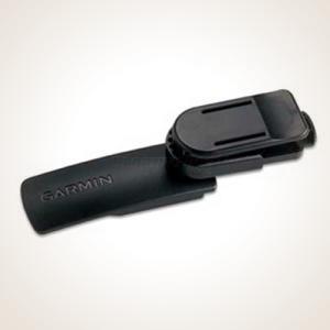
![Garmin Belt Clip]() Garmin Belt Clip$9.99
Garmin Belt Clip$9.99![Garmin]()
Belt clip for Garmin Astro 320 and Alpha handhelds. Keeps the unit on your hip and within reach without occupying a pocket...
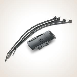
![Garmin Handlebar/ATV Mount]() Garmin Handlebar/ATV Mount$9.99
Garmin Handlebar/ATV Mount$9.99![Garmin]()
Handlebar or ATV mount for Garmin Astro 320 and Alpha 100 handhelds. Fits bars up to 1” diameter. Includes mounting hardware...
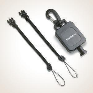
![Garmin Astro Retractable Lanyard]() Garmin Retractable Lanyard$24.99
Garmin Retractable Lanyard$24.99![Garmin]()
Retractable lanyard keeps your Garmin Astro or Alpha handheld tethered to your vest, belt, or jacket while keeping it accessible. Compatible with Astro and Alpha handhelds...
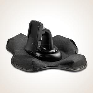
![Garmin Astro 320 Car Friction Mount]() Garmin Astro 320 Car Friction Mount$44.99
Garmin Astro 320 Car Friction Mount$44.99![Garmin]()
Weighted friction mount holds your Garmin Astro 320, Astro 430, or Alpha handheld on any flat surface in your vehicle — no permanent attachment required. Compatible with Astro 320, Astro 430, and Alpha handhelds...
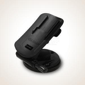
![Garmin Astro 320 Cart Mount]() Garmin Astro 320 Car Mount$29.99
Garmin Astro 320 Car Mount$29.99![Garmin]()
Flat-surface mount for Garmin Astro 320 and Astro 430 handhelds. Screws to any flat surface — dash, cart, boat console — for a permanent or semi-permanent installation...
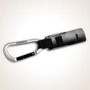
![Garmin Carabiner Clip]() Garmin Carabiner Clip$12.99
Garmin Carabiner Clip$12.99![Garmin]()
Carabiner clip for Garmin Astro 320, Astro 430, and Alpha handhelds. Clips to a vest, pack, or belt loop to keep the handheld in reach while moving...
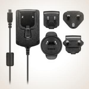
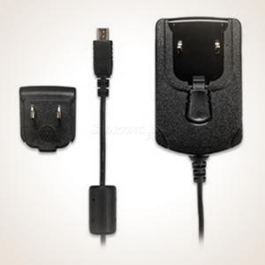
![Garmin AC Adapter Cable for Pro Models]() Garmin AC Adapter Cable for Pro Models$34.99
Garmin AC Adapter Cable for Pro Models$34.99![Garmin]()
Replacement wall AC adapter for Garmin PRO series handhelds and dog devices — PRO 70, PRO 550, PRO 550 Plus, Sport PRO, and PRO Trashbreaker...
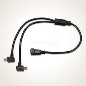
![Garmin Split Adapter Cable]() Garmin Split Adapter Cable$12.99
Garmin Split Adapter Cable$12.99![Garmin]()
Y-adapter cable that lets you charge two compatible Garmin devices simultaneously from a single power source — one AC adapter or one vehicle outlet. Compatible with Alpha 100, TT10, Delta, Delta Sport, PRO 70, PRO 550, and PRO Trashbreaker...
![Garmin Alpha AC Adapter Cable]() Garmin Alpha AC Adapter Cable$29.99
Garmin Alpha AC Adapter Cable$29.99![Garmin]()
Wall AC adapter cable for Garmin Alpha 100 handheld and older-connector Garmin collar devices including TT10, TT15, TT15X, T5, T5X, PT10, TB10, and Delta collars (charging clip required for collar devices, sold separately)...
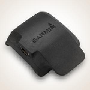
![Garmin Delta Charge Clip]() Garmin Delta Charge Clip$12.99
Garmin Delta Charge Clip$12.99![Garmin]()
Replacement charging clip for the Garmin Delta and Delta Sport dog device. Snap the collar onto the clip to recharge...
![Garmin BarkLimiter Deluxe Replacement Charging Clip]() Garmin BarkLimiter Deluxe Replacement Charging Clip$12.99
Garmin BarkLimiter Deluxe Replacement Charging Clip$12.99![Garmin]()
Replacement charging clip for the Garmin BarkLimiter™ Deluxe. Direct replacement if the original clip is lost or damaged...
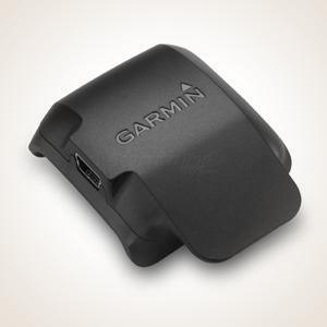
![Garmin TT-10 Charging Clip]() Garmin TT-10 Charging Clip$9.99
Garmin TT-10 Charging Clip$9.99![Garmin]()
Replacement charging clip for the Garmin TT10 dog tracking and training collar. Direct replacement for a lost or damaged original...
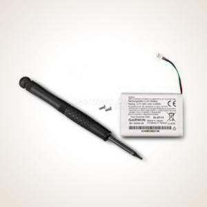
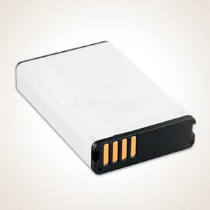
![Garmin Li-Ion Battery for Pro Dog Device]() Garmin Li-Ion Battery for Pro Dog Devices$29.99
Garmin Li-Ion Battery for Pro Dog Devices$29.99![Garmin]()
Replacement lithium-ion battery for Garmin PRO series dog devices — PT10, TB10, and compatible PRO training collar receivers...
![Garmin Bark Limiter Deluxe Replacement Battery]() Garmin Bark Limiter Deluxe Replacement Battery$39.99
Garmin Bark Limiter Deluxe Replacement Battery$39.99![Garmin]()
Replacement battery assembly for the Garmin BarkLimiter™ Deluxe bark collar. Direct replacement or spare...
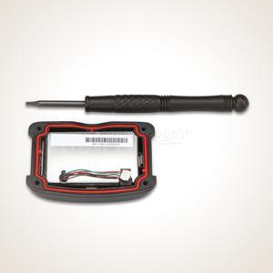
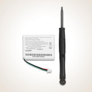
![Garmin Battery for Delta Handheld Receivers]() Garmin Battery for Delta Handheld Receivers$33.99
Garmin Battery for Delta Handheld Receivers$33.99![Garmin]()
Replacement rechargeable lithium-ion battery for the Garmin Delta and Delta Sport handheld transmitter...
![Garmin Alpha Battery]() Garmin Alpha Battery$47.99
Garmin Alpha Battery$47.99![Garmin]()
Replacement lithium-ion battery for Garmin Alpha series handhelds — Alpha 100, Alpha 200, Alpha 200i, Alpha 300, and Alpha 300i...
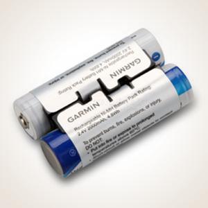
![Garmin NiMH Battery Pack]() Garmin NiMH Battery Pack$29.99
Garmin NiMH Battery Pack$29.99![Yes]()
![Garmin]()
Rechargeable NiMH battery pack for the Garmin Astro 430 handheld. Replaces two AA batteries; charges via the Astro’s AC adapter or USB cable. Also compatible with Garmin Oregon 6xx and GPSMap 64 series units...
![Gamin Pro 550 Handheld Transmitter]() Garmin Pro 550 Handheld Transmitter$269.99
Garmin Pro 550 Handheld Transmitter$269.99![Yes]()
![Garmin]()
Replacement or second handheld transmitter for the Garmin PRO 550 dog training system. Controls up to 3 dogs at 1-mile range. IPX7 waterproof, 80-hour battery. Handheld only — dog devices sold separately...
![Garmin Pro Trashbreaker Transmitter / Handheld]() Garmin Pro Trashbreaker Transmitter / Handheld$269.99
Garmin Pro Trashbreaker Transmitter / Handheld$269.99![Yes]()
![Garmin]()
Replacement or second handheld transmitter for the Garmin PRO Trashbreaker system. Controls up to 9 dogs at 4-mile range with trash-breaking correction. Handheld only — TB10 dog devices sold separately...
![Garmin Pro 70 Handheld Transmitter]() Garmin Pro 70 Handheld Transmitter$169.99
Garmin Pro 70 Handheld Transmitter$169.99![Yes]()
![Garmin]()
Replacement or second handheld transmitter for the Garmin PRO 70 dog training system. Controls up to 6 dogs at 1-mile range. IPX7 waterproof, 80-hour battery. Handheld only — dog devices sold separately...
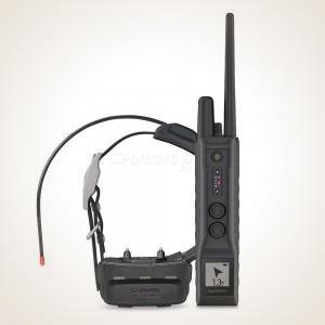
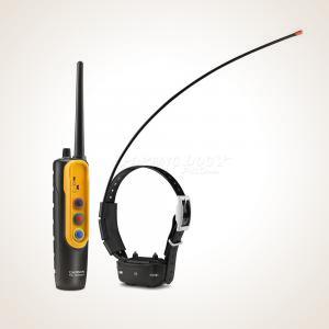
![Garmin Alpha 300 with TT25 Tracking & Training System]()
"Best for tracking."
Garmin Alpha 300 Tracking & Training System$1,149.98![Up to 9 Miles]()
![Up to 20 Dogs]()
![Yes]()
![Garmin]()
![Stimulation Type]() Continuous, Momentary, Vibration, Tone
Continuous, Momentary, Vibration, ToneThe Garmin Astro 300 is a top-tier GPS tracking and training system, ideal for outdoor enthusiasts and professional dog trainers. It features robust, water-resistant design, advanced GPS/GLONASS tracking, customizable training options with the TT25 collar, and excellent battery life, ensuring reliable, precise tracking and effective training in any environment...
![Garmin Alpha 200 Tracking & Training System]() Garmin Alpha 200 Tracking & Training System$1,049.98
Garmin Alpha 200 Tracking & Training System$1,049.98![Up to 9 Miles]()
![Up to 20 Dogs]()
![Yes]()
![Garmin]()
![Stimulation Type]() Continuous, Momentary, Vibration, Tone
Continuous, Momentary, Vibration, ToneTrack and train up to 20 dogs from up to 9 miles on a 3.5" touchscreen. The Alpha 200 pairs with Garmin's new TT25 collar — universally sized for large and small breeds, with Dynamic Tracking for up to 68 hours of collar battery life and seven-color LED beacon lights you control from the handheld. Full TopoActive mapping, Hunt Metrics, and Garmin Explore app support included. The go-to GPS tracking and training system for serious hunters..
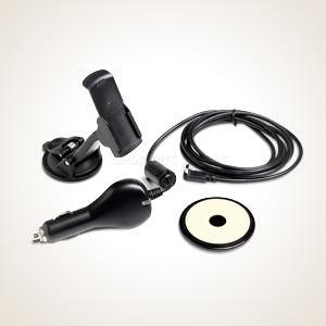
![Garmin Auto Navigation Kit for Astro 320]() Garmin Auto Navigation Kit for Astro 320$49.99
Garmin Auto Navigation Kit for Astro 320$49.99![Garmin]()
Auto navigation kit for use with Garmin Astro and Alpha handhelds. Includes friction mount and vehicle power cable for in-vehicle tracking while driving...
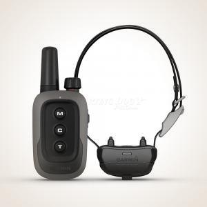
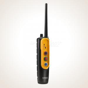
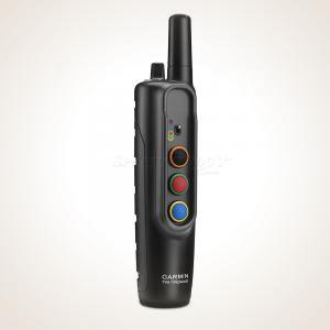
![Garmin / Tri-tronics Pro Control 2 Remote Release System]() Garmin PRO Control 2 Remote Release System$299.99
Garmin PRO Control 2 Remote Release System$299.99
List: $349.99![700 Yards]()
![Up to 3 Dogs]()
![Garmin]()
![Stimulation Type]() Continuous, Momentary, Vibration, Tone
Continuous, Momentary, Vibration, ToneGarmin's upgrade to the popular Pro Control platform — the transmitter that lets you run your Zinger Winger or other compatible launcher from the same remote you're already holding. The PRO Control 2 transmitter controls up to 18 receivers (with advanced functions capable of addressing 36), is backwards compatible with existing Pro Control G3 receivers, and adds the ability to control up to 3 dogs wearing Garmin Delta training collars simultaneously. One remote for launchers and collars — no juggling two handhelds at the line. 700-yard range. Compatible with Zinger Winger, Dogtra, and most other remote-ready launchers. Includes transmitter and one receiver...
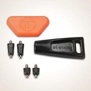
![Garmin TT10 Contact Point Kit]() Garmin Contact Point Kit$14.99
Garmin Contact Point Kit$14.99![Garmin]()
Long and short contact point set for Garmin TT10, TT15, PRO series, Sport PRO, Delta XC series, and Tri-Tronics G2/G3 collars. Direct replacement for worn or lost contact points...
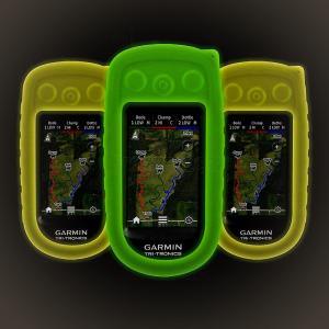
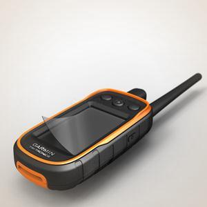
![Garmin Alpha Glow in the Dark Cover]() Garmin Alpha Glow in the Dark Cover$21.99
Garmin Alpha Glow in the Dark Cover$21.99![Yes]()
![Garmin]()
Glow-in-the-dark protective cover for the Garmin Alpha 100 handheld. Glows for several hours; all buttons and ports remain accessible. Available in green or orange...
![Garmin Alpha Screen Protectors]() Garmin Alpha Screen Protectors$9.99
Garmin Alpha Screen Protectors$9.99![Garmin]()
Screen protectors for Garmin Alpha series handhelds. Reduces fingerprint smudges and protects the touchscreen from scratches...
![Nylon Case with Zipper for Garmin Astro 320]() Nylon Case with Zipper for Garmin Astro 320$18.99
Nylon Case with Zipper for Garmin Astro 320$18.99![Garmin]()
Nylon zipper carrying case for Garmin Astro and Alpha handhelds. Protects the unit in storage or in the field...
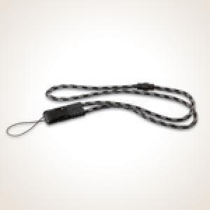
![Garmin Lanyard]() Garmin Lanyard$13.99
Garmin Lanyard$13.99![Garmin]()
Quick-release lanyard for Garmin Astro and Alpha handhelds. Wear the unit around your neck for hands-free access in the field...
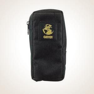
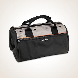
![Garmin Field Bag]() Garmin Field Bag$39.99
Garmin Field Bag$39.99![Garmin]()
Padded carry bag for Garmin dog tracking and training gear. Keeps your handheld, collars, cables, and accessories organized in one bag for the field...
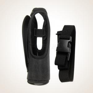
![Garmin PRO Series Holster - Black]() Garmin Pro Series Holster$27.99
Garmin Pro Series Holster$27.99![Garmin]()
Belt holster for Garmin PRO 70, PRO 550, and PRO Trashbreaker transmitter/handhelds. Keeps the handheld secure and accessible at the hip...


Derrick Moore, Senior Field Staff